geography

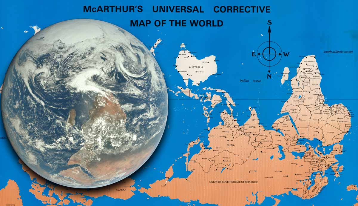
South-up maps are challenging traditional views of the Earth—and the political and cultural beliefs that go with them.
Spectacular new open geospatial project by [Dan Snow](https://sno.ws/): > OpenTimes is a database of pre-computed, point-to-point travel times between United States Census geographies. It lets you download bulk travel time …

Mapping companies like Google Maps and Apple’s Maps navigate government pressure and political disputes over sea names. Here’s how they decide what to display.

How to visualize country borders with Python

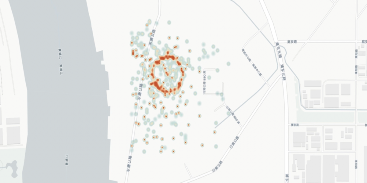
Strategically enhancing address mapping during data integration using geocoding and string matching
Understanding spatial trends in the location of Tokyo convenience stores
What do we lose when we forget about locations like "Troll's Cave" and "Window Claw"?
A ready-to-run code which identifies and anonymises places, based on the GeoNames database
Build geo specific subset of LAION-5B
Build the next generation of Location Intelligence applications with the Targomo API

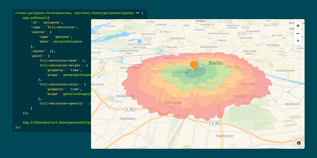
Learn how to create isochrones for different transport modes with our free isochrone map generator, Isochrone API or software plugins.

In 2019 there are a myriad of options for mapping and geolocation services. Rails geocoder gem makes it easy to find your way around those services.
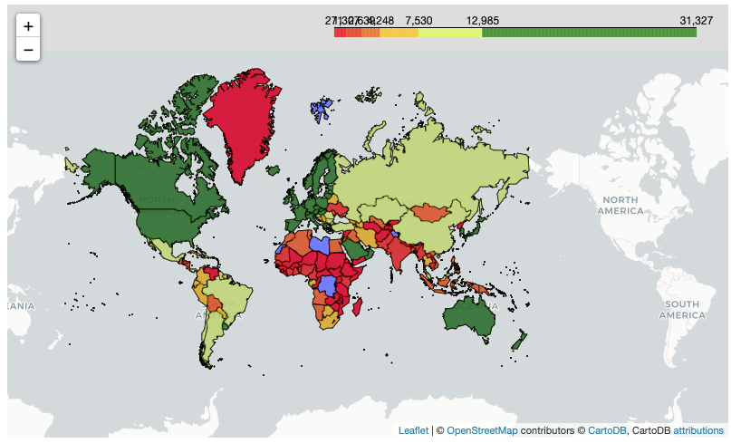
Using the Folium Package to Create Stunning Choropleths
Maps and geography have been a long passion of mine, especially in my International Relations background. A side goal of mine as I grow as…
Create interactive maps with just a few lines of Python code
The last decade has witnessed an experimental revolution in data science and machine learning, epitomised by deep learning methods. Indeed, many high-dimensional learning tasks previously thought...
Part 1: Introduction to geospatial concepts (follow here) Part 2: Geospatial visualization and geometry creation (follow here) Part 3: Geospatial operations (this post) Part 4: Building geospatial…
The principle of equivariance to symmetry transformations enables a theoretically grounded approach to neural network architecture design. Equivariant networks have shown excellent performance and...

As a part of the Data Science community, Geospatial data is one of the most crucial kind of data to work with. The applications are as…
Geometric Algebra for Python.
How to easily and effectively incorporate spatial features in Python using Geopandas
Squaring the Earth
How to use GeoPandas and Leaflet?
Sentinel-2 L1C imagery taken on October 15, 2024
Open source tools and techniques for visualizing data on custom maps
A Walkthrough on Hyperspectral Image Analysis Using Python.

The ultimate guide on open source GIS tools for spatial analysis. Find the tools you need to support your next spatial data project!
Tutorial — Triggering notifications and Nudging GPS locations from users.

22K subscribers in the rubyonrails community. Everything RoR! Ruby on Rails, often simply Rails, is an open source web application framework which…
A sophisticated new electronic warfare system is being used at the world’s busiest port. But is it sand thieves or the Chinese state behind it?
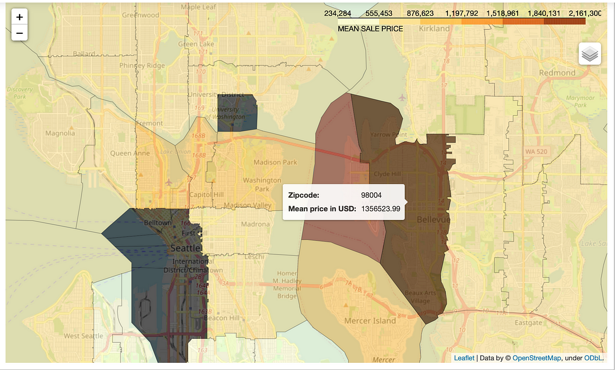
In this article, we explore 7 interesting yet simple techniques to visualize geospatial data that will help you visualize your data better.